
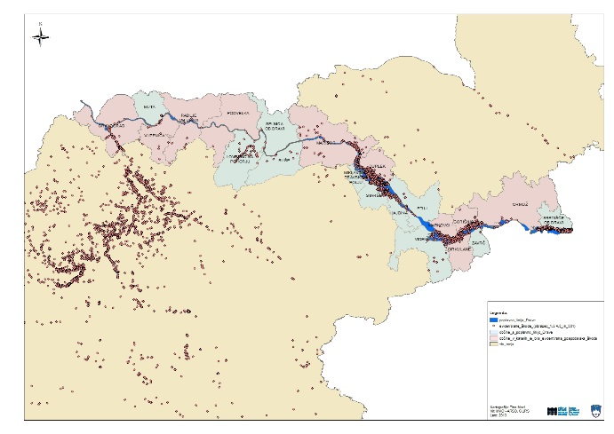
On the basis of the available data on flood damage relating to the flood event on the Drava on 5 November 2012, it was necessary to assess the difference between the damage that actually occurred (as reported and recorded) and the damage that would have occurred had the flow of the Drava been approximately 700 m³/s lower, i.e. the so-called ‘natural’ flow. Data on damage from the AJDA system (URSZR) and economic damage (obtained from the website of the Ministry of Economic Development and Technology) were used.
The approach selected in the study for determining the damage assessment follows the basic objective, i.e. to determine the order of magnitude of the difference in damage, which will assist the competent authorities in deciding on further steps.
Data used in the damage assessment
- Damage recorded in the AJDA system
- Economic damage
- Response costs
- Extent of the Drava floodplains
Basis and assumptions used in the damage assessment
- Division of the entire Drava floodplain under consideration, covering an area of 73 km², into 33 areas based on municipal boundaries and the locations of the dam cross-sections on the Drava;
- The recorded levels of damage (AJDA, MGRT, intervention costs) are actual;
- The analysis of seven smaller floodplains, covering a total area of 54 km², where more data was available, is representative of the entire Drava floodplain under consideration;
- The floods may also have caused damage not covered by this analysis, meaning that the difference in damage could be even greater;
- The extent of the Q100 flood (VGB_2013) is greater than it would be under ‘natural’ flow (Q40, IzVRS_2013);
- The damage within the Q100 flood extent is greater than or equal to that under ‘natural’ flow (Q40);
- The Q10 flood extent is smaller than it would be under ‘natural’ flow (Q40);
- The damage within the Q10 flood extent is less than that for the ‘natural’ flow (Q40);
- The water depth at Q40 is 0.5 m less than the depth at Q100;
- For the flood area at the “natural” flow rate Q40, the assumed flood area envelope is that for flow rate Q10 plus the depth class G2 area (depths from 0.5 to 1.5 m at Q100) + the G3 depth class area (depths greater than 1.5 m at Q100);
- Damage at the same location would also be less severe due to the shallower depth and lower force of the floodwater. ‘Possible’ reduction factors have been taken into account depending on the type of damage form. Specifically, a reduction in damage of -20 per cent for damage on forms 3 and 4, and of -40 per cent for damage on forms 5 and 501;
- As the economic loss is not precisely localised, it is adjusted by the factor for the calculated reduction in losses determined using the AJDA form;
- As there are no localised intervention costs, these are adjusted by the factor for the calculated reduction in all damage and costs;
- Due to the smaller scale of flooding in the case of ‘natural’ flooding, a 20 per cent reduction in intervention costs has been taken into account;
Conclusion
The total damage caused by the flooding of the Drava is estimated at approximately €105 million.
Based on current data and the analyses carried out, we estimate that the additional flow of the Drava (approximately 700 m³/s) caused between €35 and €61 million in damage. Under natural flow conditions, the damage would have been 34–58 per cent lower than that recorded.
The floods may also have caused damage not covered by this study, which means that the difference in damage could be even greater.
In the study, we assumed that the recorded damage figures were accurate.
Keywords
About the project
REPUBLIC OF SLOVENIA MINISTRY OF AGRICULTURE AND THE ENVIRONMENT
Darko Anzeljc
#Tina Mazi
OTHER DOMESTIC REFERENCES
